Updated: 2019-07-10 5:33 p.m. Louisiana School Closures
- LSU will be closed Friday, as the state braces for the landfall of a developing storm system in the Gulf.
- The National Hurricane Center expects the system to strengthen into a tropical storm Thursday, and make landfall as Hurricane Barry, a Category 1 storm, Saturday in southwest Louisiana.
- State officials are focused on potential damage in coastal and low-lying areas. According to Wednesday’s estimates, Baton Rouge could see 6 to 10 inches of rain.
- LSU officials said students who live in campus dormitories will be allowed to stay there, but advised them to monitor updates from the school as the situation develops.
- Classes at the University of New Orleans have been cancelled from Thursday to Saturday. Loyola University New Orleans will be closed Thursday and Friday.
Updated: 2019-07-10 4:34 p.m. Mayor Cantrell & City of New Orleans preparing for upcoming storm.

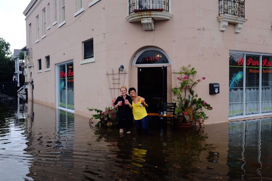
- Sewerage and Water Board director Ghassan Korban says there were two minor glitches with the pump system Wednesday morning, but those were only brief and had almost no effect on the flooding. He says 118 of the 120 pumps were working and that the flooding was simply due to too much rain in a short time span.
- A tropical depression is likely to form in the Gulf of Mexico by Thursday morning, according to the National Weather Service. Initial forecasts show the storm moving slowly toward the Texas-Louisiana state line.
- As a result, the National Weather Service says up to 12 inches of rain are possible through Monday morning across south Louisiana.
- The system will also bring storm surge to coastal regions. Storm surge watch is currently in effect for all Parishes of Southeast Louisiana.
- Storm surge could push water up the Mississippi River, which was already extremely high due to river flooding. The storm surge, plus high river levels means many sections of river levee are at risk of overtopping -- in both Orleans and Plaquemines Parish.
- In Plaquemines Parish, voluntary evacuations are in effect starting at 4pm Wednesday for the entire East Bank, and for the West Bank from Oakville to Venice. Mandatory evacuations begin at 6am Thursday morning for those same areas.
- In Orleans Parish, two sections of river levee are vulnerable to overtopping: the lock of the Industrial Canal, and the Uptown headquarters of the Army Corps of Engineers. The levees at both of those locations can be overtopped when the river reaches 20 feet at the Carrollton Gauge. The river is currently forecast to reach 20 feet on Saturday afternoon.
- The New Orleans Fire Department and EMS will have extra staff on hand over the next few days to handle any potential emergency situations.
- Local officials urged residents to ready their hurricane plans. Tips for hurricane planning can be found at Ready.Nola.gov
- Officials also urged residents to drive as little as possible, and if driving is absolutely necessary, not to drive through water.
Updated: 2019-07-10 1:34 p.m. Edwards Declares State of Emergency
Louisiana can expect widespread heavy rainfall and coastal flooding as a result of a weather system expected to make landfall in the state sometime Saturday.
Governor John Bel Edwards declared a statewide emergency Wednesday afternoon ahead of the storm’s impact.
“We know this is going to be a Louisiana event now, in all probability, based upon a confluence of various models,” Governor John Bel Edwards said at a press conference in Baton Rouge Wednesday morning.
Edwards says the entire coast of Louisiana is at play for flooding, but efforts are being focused in the southeast, especially Plaquemines Parish.
Making the storm more difficult to deal with are the high levels of the Mississippi River.
“That will exacerbate many of the issues that we're going to face in Louisiana, especially if the brunt of the storm hits in the southeast part of the state,” Edwards said.
The governor warns some levees could overtop in Plaquemines Parish. At this point, any overtopping would be expected to last about half a day. Any evacuations in that area will be determined by the parish officials.
Edwards will address any updates at a second press conference Thursday afternoon.
Updated: 2019-07-10 6:44 a.m. Photos of Flooding in New Orleans


Updated: 2019-07-10 10:55 a.m.


