This story is no longer being updated. Find the latest forecast track here.
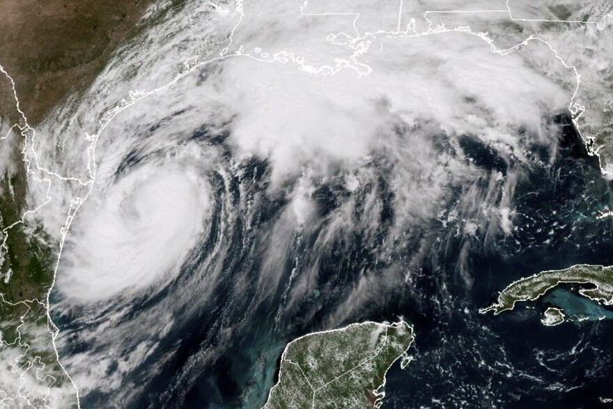
Francine strengthened into a hurricane Tuesday evening as it headed toward Louisiana, where it's expected to make landfall as a Category 1 hurricane Wednesday.
The storm is forecast to make landfall in Louisiana sometime Wednesday as a Category 1 hurricane with approximately 92 mph winds.
Where is Francine?
At 1 a.m. CT Wednesday, Francine was about 275 miles southwest of Morgan City, with maximum sustained winds of 90 mph. It was moving northeast at 10 mph.
The National Hurricane Center said the storm was getting stronger. It's expected to bring "life-threatening storm surge and hurricane-force winds" to Louisiana beginning Wednesday.
New Orleans was placed under a hurricane watch Tuesday afternoon, meaning hurricane conditions are likely over the next two days.

Where is Francine headed?
The storm is forecast to move across the northwestern Gulf Tuesday evening, before it makes landfall in Louisiana sometime Wednesday afternoon or evening.
After it makes landfall, Francine is expected to head north into Mississippi Wednesday evening.
How could it impact Louisiana?
It’s too soon to determine the exact timing and location of the storm’s landfall, but it's expected to bring potentially life-threatening storm surge and damaging winds to parts of Louisiana beginning Tuesday night.

Southern Louisiana and other areas along the Gulf Coast could see up to 8 inches of rain into Thursday morning with some areas seeing isolated amounts of 12 inches, which could cause considerable flash and urban flooding.

Forecasters said the storm surge could bring water between 3 to 10 feet above ground level in some parts.
Watches in effect
A storm surge warning is in effect for:
- Sabine Pass Texas to the Mississippi/Alabama Border
- Vermilion Bay
- Lake Maurepas
- Lake Pontchartrain
A hurricane warning is in effect for:
- The Louisiana coast from Cameron eastward to Grand Isle
A storm surge watch is in effect for:
- Mississippi/Alabama Border to the Alabama/Florida Border
- Mobile Bay
A hurricane watch is in effect for:
- Lake Maurepas and Lake Pontchartrain, including metropolitan New Orleans
A tropical storm warning is in effect for:
- Texas and Louisiana coasts east of High Island to Cameron
- East of Grand Isle Louisiana to the Alabama/Florida border
- Lake Maurepas and Lake Pontchartrain, including metropolitan New Orleans
Be prepared
Be sure to monitor weather updates, and have a plan in place. Use this guide to help you and your family prepare.


